
F U N D A C I Ó N
C O N T E X T O
A T A C A M A
ESTUDIO, PROTECCIÓN Y DESARROLLO DE LOS CONTEXTOS URBANOS Y ARQUITECTÓNICOS PATRIMONIALES DE LAS COMUNIDADES DEL DESIERTO DE ATACAMA - CHILE

Taller María Elena
María Elena Workshop
La Epopeya del Desierto de Atacama
Vertiente oriental de la Cordillera de los Andes, región de Antofagasta.
El área conocida como desierto de Atacama (Depresión Intermedia), situado aproximadamente entre los 22° y 26° de latitud sur, entre el rio Loa y la ciudad de Taltal, resulta poco propicia para el asentamiento de base agrícola. Esta condición tiene su origen en la escasez de recursos hídricos, calidad inerte del suelo y condiciones climáticas extremas, las cuales incluyen escasa humedad relativa, alta temperatura y oscilaciones importantes de esta (con máximas de 35° C en diciembre y mínimas de 6° C en Junio), así como gran luminosidad, con un promedio de 38.000 lux y una altura media sobre el nivel del mar de 1.200 m.
Las características más relevantes de la ocupación del territorio se pueden resumir en los siguientes aspectos:
En primer lugar, el territorio se ocupó a base de ASENTAMIENTOS AUTÓNOMOS, las oficinas salitreras que se dispusieron de acuerdo a la localización de los recursos. El concepto de AUTONOMÍA es de gran importancia, ya que de ella derivan algunas de las peculiaridades específicas de los asentamientos.
Por otra parte, es claro que no se trató de una planificación abstracta del territorio, sino que estuvo asociada con la posición de los yacimientos, situación que derivó en el desarrollo de los cantones salitreros. Entendidos como CIRCUNCRIPCIONES GEOGRÁFICO-ADMINISTRATIVAS, los cantones se constituyeron a partir de la organización de un conjunto de oficinas, relacionadas con un área territorial común, que se vincularon a un ferrocarril y se conectaron a un mismo puerto.
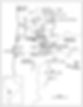
Sistema de Ex Oficinas salitreras en la región de Antofagasta.

The Epic of the Atacama Desert
The area known as the Atacama Desert (Intermediate Depression), located approximately between 22 ° and 26 ° south latitude, between the River Loa and the city of Taltal, is not very conducive to the establishment of an agricultural base. This condition has its origin in the shortage of water resources, inert soil quality and extreme climatic conditions, which include low relative humidity, high temperature and important oscillations of it (with maximum of 35 ° C in December and minimum of 6 ° C in June), as well as great luminosity, with an average of 38,000 lux and an average height above sea level of 1,200 m.
The most relevant characteristics of the occupation of the territory can be summarized in the following aspects:
First, the territory was occupied by autonomous settlements, nitrate offices that were arranged according to the location of resources. The concept of AUTONOMY is of great importance, since it derives some of the specific peculiarities of the settlements.
On the other hand, it is clear that it was not an abstract planning of the territory, but that it was associated with the position of the deposits, a situation that led to the development of the nitrate cantons. Understanding as GEOGRAPHIC-ADMINISTRATIVE CIRCUMSTANCES, the cantons were constituted from the organization of a set of offices, related to a common territorial area, which were linked to a railway and connected to the same port.
En el marco de los intercambios estudiantiles que tiene por convenio nuestra Universidad Católica del Norte en Antofagasta, donde llegan anualmente a nuestra Escuela de Arquitectura, alumnos de diversos países latinoamericanos y europeos, los cuales una vez concluidos sus cursos correspondientes, se abre la convocatoria a este taller, donde tenemos que considerar los siguientes aspectos:
-
Trabajar con un grupo de 8 estudiantes.
-
Realizar el trabajo en 3 jornadas consecutivas.
-
Generar una visita respetuosa del medio ambiente, y las cultura, inmersa en estos lugares como la Lickan Antay, buscando generar el menor impacto posible.
RUTA CULTURAL CUENCA RÍO SALADO - SAN PEDRO DE ATACAMA
La Cuenca del Río Salado, en la Provincia del Loa es cuna de importantes asentamientos de la cultura Lickan Antay, los cuales en más de 11.000 años a sido capaz de mantener viva tradiciones y expresiones culturales muy importantes desde los asentamientos mismos, terrazas de cultivos, canales de regadíos a festividades religiosas que coexistieron a partir de la conquista española.
Uno de los aspectos más relevantes desde el punto de vista del desarrollo cultural expresado en su arquitectura es sin duda los Pukarás o fortalezas, las cuales en esta área se desarrollaron mayormente que en el área del Salar de Atacama, debido en gran medida a la cercanía con el área altiplánica -actual Bolivia- y
METODOLOGÍA
La ruta partió en la ciudad de Calama, y fue recorriendo los asentamientos andinos de :
-
San Francisco de Chiu Chiu
-
Pukará de Chiu Chiu
-
Valle de Lasana
-
Pukará de Lasana
-
Vegas de Turi
-
Aldea de Turi
OBJETIVOS
-
Entregar al alumno extranjero, un acercamiento real con la cultura Lickan Antay, en la Cuenca del Río Salado, hospedando en casas de los propios habitantes y comiendo de sus alimentos, siendo esta una experiencia única e irrepetible en cada uno de los asentamientos de la cuenca.
-
Aportar a las labores que la Universidad realiza a través del Intercambio estudiantil, entregándoles en una actividad propiamente extra programática, una experiencia paralela al ámbito académico de la Universidad.
-
Incorporar a alumnos de nuestra propia escuela, para que sean parte de este taller, considerando que muchos de estos lugares no son conocidos, ni son parte de un circuito turístico.
Within the framework of the student exchanges that our Catholic University of the North has in agreement in Antofagasta, where they arrive annually to our School of Architecture, students of diverse Latin American and European countries, which once concluded their corresponding courses, the call to this workshop, where we have to consider the following aspects:
-
Work with a group of 8 students.
-
Carry out the work in 3 consecutive days.
-
Generate a respectful visit of the environment, and culture, immersed in these places like the Lickan Antay, looking to generate the least possible impact.
CULTURAL ROUTE CUENCA RÍO SALADO - SAN PEDRO DE ATACAMA
The Salado River Basin, in the Province of Loa, is the cradle of important settlements of the Lickan Antay culture, which in more than 11,000 years has been able to keep alive very important cultural expressions and traditions from the settlements themselves, terraces of crops, Irrigation channels to religious festivities that coexisted from the Spanish conquest.
One of the most relevant aspects from the point of view of cultural development expressed in its architecture is undoubtedly the Pukarás or strengths, which in this area were developed mostly in the area of the Salar de Atacama, largely due to the proximity with the altiplanic area -currently Bolivia- and south of present-day Peru, where the most important invaders arrived
METHODOLOGY
The route started in the city of Calama, and was touring the Andean settlements of:
-
San Francisco de Chiu Chiu
-
Pukará of Chiu Chiu
-
Lasana Valley
-
Pukará de Lasana
-
Vegas de Turi
-
Village of Turi
OBJECTIVES
-
To give the foreign student a real approach with the Lickan Antay culture, in the Salado River Basin, staying in the homes of the inhabitants themselves and eating their food, this being a unique and unrepeatable experience in each of the settlements of the basin .
-
Contribute to the work carried out by the University through the Student Exchange, giving them in an activity that is extra programmatic, an experience that is parallel to the University's academic environment.
-
Incorporate students from our own school, to be part of this workshop, considering that many of these places are not known, nor are they part of a tourist circuit.
Exposición en interior de vivienda en María Elena.
Exposición al interior del Mercado de María Elena.
Trabajo grupal en exposición del examen de fin de semestre. 2018


Imagen aérea de la Oficina salitrera María Elena.


Exposición al exterior del nuevo Municipio de María Elena.
FICHA TÉCNICA
Guía
Cristian Games Díaz
Lugar
Oficina Salitrera María Elena, región de Antofagasta.
2015 -
Detalle fachada de la Ex Municipalidad de María Elena.
Vertiente oriental de la Cordillera de los Andes, región de Antofagasta.


